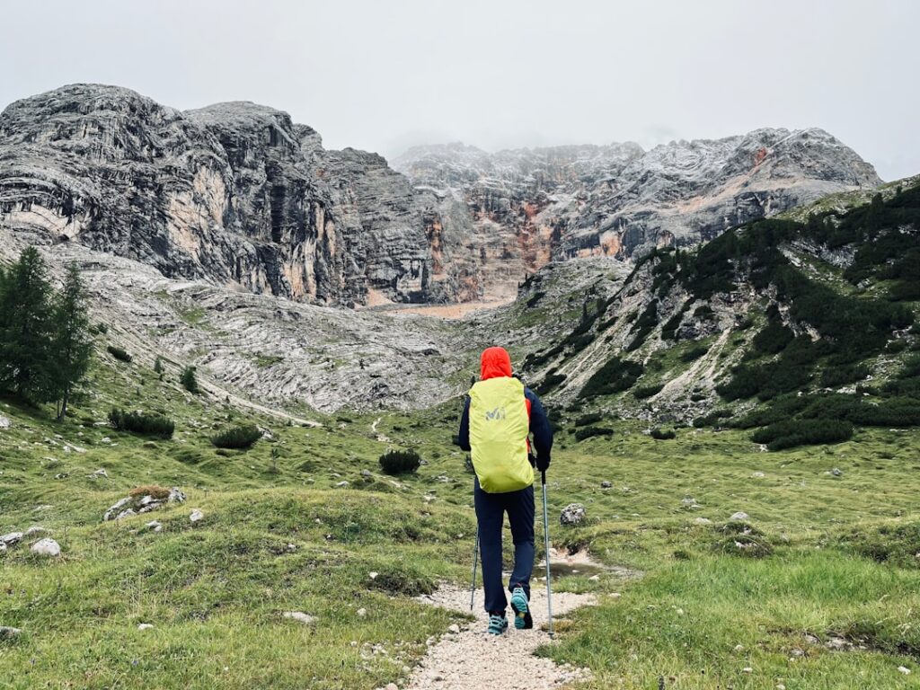






Introduction — Trento and its climbs: a panorama of effort and emotion
Trento, sitting in the heart of Trentino, is the perfect gateway to demanding and varied mountain routes. Framed by limestone massifs and Dolomitic peaks, the province serves up technical, physically challenging hikes for fit trekkers who crave steep elevation gains, airy ridgelines and jaw-dropping alpine panoramas. This guide is aimed at sporty hikers: you’ll find detailed route descriptions, practical info (start point addresses, indicative costs, opening hours and local tips) plus sensory notes to help you prepare for climbs around Trento.
Beyond peak names, it’s essential to understand the conditions: fast-changing alpine weather, exposed sections that may require a helmet and possibly a lanyard or via ferrata kit, and refuges that close off-season. The routes presented here are not family strolls; they demand fitness, the right gear (sturdy mountain boots, technical clothing, rope/harness for some ridges) and careful pacing and nutrition management. Landscapes vary widely — lush spring meadows, scree and rocky ridges in summer, and lingering snowfields at the start and end of the season.
Trento benefits from solid logistics: train stations, parking, mountain huts and tourist information points. Still, every starting point requires checking access times (lifts, shuttle buses) and the status of refuges if you plan an overnight. The tips below mix geographic precision with local know-how: tourist office opening times, rough lift and refuge prices, parking addresses and water points. The aim is to give you an operational guide so your ascent is not only challenging but also safe and well planned.
Before heading out, check local forecasts (Servizio Meteorologico Trentino), let someone know your route, and carry a detailed topographic map (Tabacco 1:25 000 or Kompass) plus a GPS or hiking app. Finally, respect the environment: stick to marked trails, pack out your trash, and learn about protection rules in natural areas, especially in places like the Adamello-Brenta Nature Park.
1) Monte Bondone — route from Vason: steady climb and alpine views (250+ words)
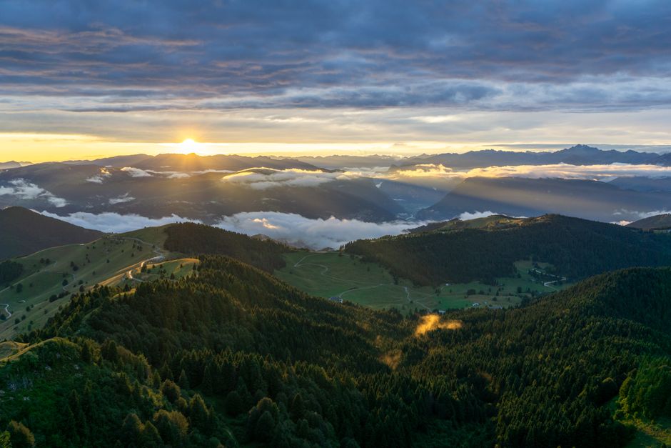
Monte Bondone is the best-loved nearby massif for locals in Trento. Just a few kilometres from the city, it offers demanding routes with sustained elevation gain and exposed ridge sections. The main start is at Vason, a developed alpine meadow area southwest of the summit with visitor facilities and parking.
Start point: Località Vason, 38123 Trento TN, Italy (Vason parking, GPS 46.0325, 11.0370). Parking costs: short stays often free; seasonal paid lots roughly €5–10/day in high season in managed areas. Access: SP85 from Trento; in summer shuttles and local buses serve Vason (check http://www.trentinotrasporti.it for schedules). Recommended start times: early morning between 06:00 and 08:00 to avoid heat and afternoon storms.
Suggested sporty route: path no. 204 – Strada delle Malghe up towards Trento Monte Bondone (direct line to the summit). Approximate distance: 12 km round-trip, elevation gain ±1,200 m, duration 6–8 h depending on pace. Terrain: steep trails, sections crossing scree, and about 300 m of exposed summit ridge. Difficulty: T/E hard; occasional grade II scrambling or exposed walking (bring helmet, poles and for the less confident possibly a rope).
Hut and services: Rifugio Capanna Grassi – Località Vason, 38123 Trento TN. Exact address: Strada del Bondone 1, 38123 Vason (Rifugio Capanna Grassi, phone +39 0461 000000 to be confirmed). Opening times and prices: mainly open June–September; meals €15–25; dorm beds €25–40; booking recommended for weekends. Local tips: carry extra water (few refill points above ~1,500 m), check spring snow conditions and bring a headlamp if you expect a late return.
2) Cima Paganella and the south ridge — demanding, with views over Lake Molveno (250+ words)
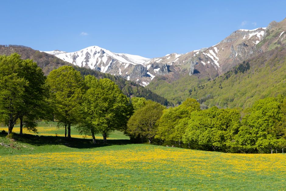
Cima Paganella overlooks the plain and Lake Molveno. Northwest of Trento, the south-ridge ascent is a sporty classic: technical in places, it provides impressive exposure and steep views down to Lake Molveno and the Adige valley. This route is great for hikers who want sustained climbing and airy ridgelines.
Start point: Andalo Park or Piazzale Paganella/Andalo. Useful address: Funivia Paganella, Via Paganella 1, 38010 Andalo TN, Italy (Andalo – Paganella cable car station; phone +39 0461 000000; check seasonal hours). Cable car fares: one-way roughly €8–15 depending on season; day passes €15–25 (indicative — confirm on the official site). Hours: generally 08:30–17:00 in summer, variable in shoulder seasons. Access road: SP36 from Trento, parking at the cable car base in 38010 Andalo TN (paid parking, rates vary).
Sporty route: start from the upper cable car station to reach the base of the south ridge; continue on an equipped path with exposed rock sections, a few handrails and metal rungs. Distance: 10–14 km round-trip depending on the loop chosen; elevation gain ±1,000–1,200 m; duration 5–7 h. Difficulty: from easy to PD- in local alpinist terms, with some easy scrambling, smooth rock and handlines. Recommended gear: helmet, gloves, boots suitable for crampons if there are snow patches, via ferrata kit if you follow equipped variants.
Huts and resupply: Rifugio La Roda Alta (seasonal) or Rifugio Dosson — check exact locations before you go. Local tips: ridgelines can be very windy — bring a thermal wind shell and strong sunglasses. In low visibility, stick to the marked trail and avoid exposed ridges; fog can reduce visibility very fast.
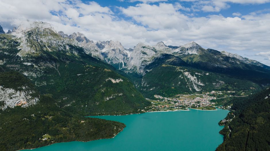
3) Adamello-Brenta Nature Park — alpine traverses and technical summits (250+ words)
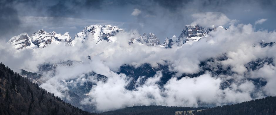
The Adamello-Brenta Nature Park is a collection of massifs and valleys where sporty hiking turns fully alpine: long traverses, limited glacial sections (on upper Adamello) and highly technical ridges in the Brenta group. For climbs around Trento, Brenta routes (southwest of Trento) offer steep couloirs and demanding ridgelines, combining via ferrata and sections that require alpine experience.
Common start: Madonna di Campiglio (38086 Madonna di Campiglio TN), tourist office address: Piazza Righi 1, 38086 Madonna di Campiglio TN, phone +39 0465 447700 (hours 09:00–18:00 in season). Suggested parking: Parcheggio Folgarida/Pinzolo depending on access; municipal paid parking in Madonna di Campiglio (around €5–12/day). Hut reservations are essential in high season.
Notable, demanding routes:
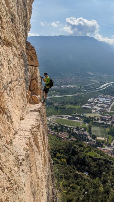
- Bocchette traverse (via ferrata) — central section “Bocchette Alte”: an exposed ridge route with ladders and suspension bridges; 8–12 h depending on variant; via ferrata gear recommended (harness, lanyards, helmet). Typical starts: Rifugio Alimonta or Rifugio Brentei depending on the section.
- Ascent of Cimon della Pala (southern Brenta side): long approaches and vertical rock sections; requires alpine climbing experience and possibly a rope.
Main huts:
- Rifugio Tuckett – Rifugio Brentei, Address: Località Bocchetta di Brenta, 38080 Madonna di Campiglio TN. Overnight: €30–60 (dorm/private depending on season). Booking phone: +39 0465 000000 (indicative).
- Rifugio Alimonta, Strada Provinciale 84, 38086 Madonna di Campiglio TN — open in summer and reachable by trails; meals €15–25, nights €25–50.
Local advice: crossing the Brenta requires strict planning — allow time for changing weather and check with hut wardens before you set off about trail and via ferrata conditions. Routes are well marked, but exposed sections demand calm nerves and solid technique. If thunderstorms are forecast, avoid ridges and descend to the valley for shelter.
4) Cima d’Ambiez and the ridge route — technical and alpine solitude (250+ words)
On the western arc of the Brenta Dolomites, Cima d’Ambiez offers a less-traveled technical ascent prized by sporty hikers seeking solitude and sculpted rock features. Southwest of Trento, this peak combines sometimes long approaches with poorly marked ridges, requiring precise navigation and confident mountain skills.
Start point: Località San Lorenzo / Val d’Ambiez. Recommended parking: Parcheggio Val d’Ambiez, Strada Provinciale 85, 38070 San Lorenzo in Banale TN (approximate coordinates — check local signs). Access: road open in summer, may close off-season for snow or maintenance. Parking fees: typically €3–8/day in managed lots.
Main route: ascent via sentiero Alto d’Ambiez, crossing sculpted rock formations and then the summit ridge. Distance: 14–18 km round-trip depending on variants, elevation gain ±1,300 m, duration 7–10 h. Difficulty: T/E+; possible grade III sections on mixed terrain. Equipment: helmet, technical boots, light rope if you expect exposed passages. Technical notes: navigation on unmarked ridges, careful descent over scree, informal klettersteig-type sections.
Support hut: Rifugio S.Antonio or small permitted bivouacs in designated areas. Useful resupply: Rifugio Albi de Ambiez, Località Val d’Ambiez, 38070 San Lorenzo in Banale TN — meals €12–25, overnight €20–40 (open in summer). Note: many huts have irregular hours — call or check local sites before you go.
Local tips: bring a stove and energy food for long stretches without services. Pack a first-aid kit, survival blanket and a whistle. The solitude is a draw but requires self-sufficiency: tell the parking attendants or San Lorenzo in Banale tourist office your intended route (Piazza, 38070 San Lorenzo in Banale TN). Go with at least one partner, stick to your planned line and build a time buffer for unpredictable weather.
Conclusion — safety, kit and final tips for your Trento ascents
The demanding climbs around Trento deliver unforgettable experiences: airy ridges, views over the Adige and alpine lakes, technical lines in the Brenta and at Monte Bondone. Preparation is key to making the most of these routes. Before each outing, check trail conditions and local weather, contact huts to confirm opening times and prices, and respect lift schedules if you plan to save elevation with cable cars.
Minimal recommended kit for a sporty hiker: stiff mountain boots, helmet, telescopic poles, 30–40 L backpack, waterproof/windproof jacket, 2–3 L water reserve, energy food (bars, dried fruit), first-aid kit, headlamp. For routes with ladders or handlines add a via ferrata set (harness + lanyard) and gloves. For high crossings or persistent snow patches carry lightweight crampons and an ice axe.
Practical tips:
- Check cable car and parking rates and schedules (the figures in this guide are indicative and may change seasonally).
- Book huts in advance for summer weekends and holiday periods (July–August). Hut and tourist office phone numbers are available via the official Trentino and parks websites.
- Always tell someone your route and estimated return time; consider using a tracking device or an app that shares your position.
- Respect Adamello-Brenta Park rules and protected area regulations: no open fires, no wild camping outside allowed zones, and protect alpine flora.
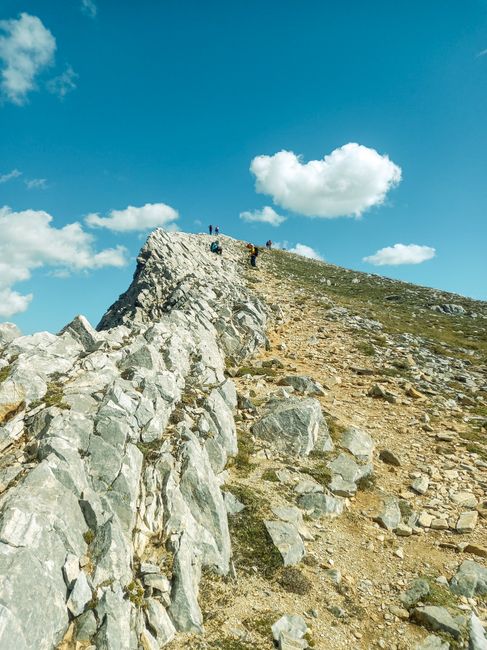
Ultimately, climbs around Trento mix physical challenge with wide-open vistas. They reward careful planning: each summit reveals sweeping perspectives over the Dolomites, Lake Molveno, deep valleys and mountain villages. Whether you’re topping out Monte Bondone at dawn, tackling Paganella’s ridge over the lake, traversing the Bocchette in the Brenta or finding solitude on Cima d’Ambiez, go prepared and with respect for the mountain. Happy trails — and remember: the best ascent is the one you prepare for the most.